Muttekopfhütte
The place
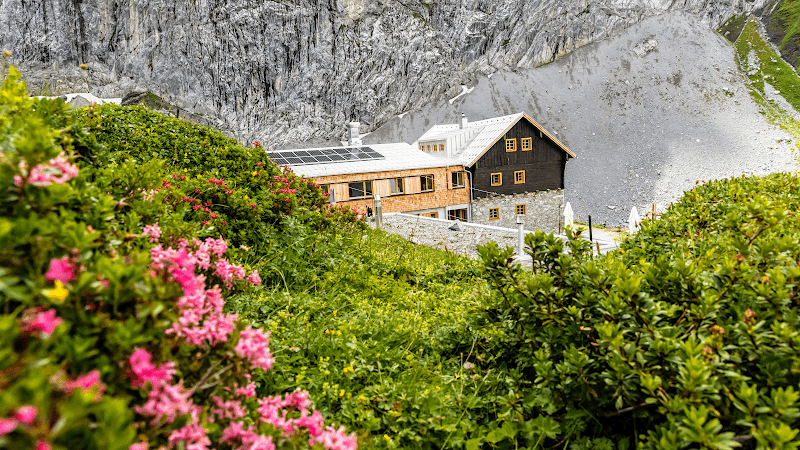
Muttekopfhütte: A Mountain Refuge at the Heart of the Alps The Muttekopfhütte is a hut of the Imst-Oberland section of the Austrian Alpine Association in the Lechtal Alps, Tyrol, Austria. Located at 1934 meters elevation, southeast of the Muttekopf, it is accessible from Imst and the Untermarkter Alm in 1½ hours or from the top station of the Alpjoch chairlift in 30 minutes. Building History The hut was built in 1874 in two weeks, at a spot already used as a camping site before. Its opening took place before mid-1874. In 1883/1884 it was extended and in 1892 it underwent a major renovation. In 1907 it was extended and in 2004/2005 it was fully renovated. Neighboring Huts and Routes To the Hanauer Hütte via the Muttekopfscharte, the Kübelwände and the Galtseitenjoch, heavily used, 6 hours. To the Anhalter Hütte via the Scharnitzsattel, the Hahntennjoch (road crossing) and the Steinjöchl, with rope and crampon safety sections at the Scharnitzsattel, 4½ hours. To the Steinseehütte through the Larsennkar, lightly used, varied, long (according to the AV guide 6 hours, likely longer), requires a good eye for terrain. Summits Muttekopf (2777 m), marked route, standard ascent, can be combined with the crossing to the Hanauer Hütte, panoramic view from the summit. Vordere Platteinspitze (2565 m), path, secured in places, varied. Maldonkopf (2632 m), Imst via ferrata. Pleiskopf (2560 m), Ödkarlekopf (2565 m), Laggers (2328 m), Imster Höhenweg, marked trail, but sometimes demanding, very long hike! Vorderes Alpjoch (2121 m), on the 'Drischelsteig' to the top station of the Alpjoch chairlift and in 10 minutes on a good path to the summit. Hinteres Alpjoch (2425 m), from the Vorderes Alpjoch on a marked trail. For experienced hikers, a connection to the Pleiskopf is possible, marked, but requires alpine experience! Hinterer Scharnitzkopf (2554 m), from the Scharnitzsattel (2441 m) on faint trail traces with a short, easy climbing section to reach, unmarked! Can be included when crossing from Muttekopf to the Anhalter Hütte. Maps German Alpine Club map 3/4 Lechtaler Alpen - Heiterwand and Muttekopfgebiet (1:25,000) Documentation Heinz Groth, Rudolf Wutscher: Guide to the Lechtal Alps. Rother Publishing, Munich, ISBN 978-3-7633-3261-8. Dieter Seibert: German Alpine Club Alpine Guide, Lechtaler Alpen. Rother Publishing, Munich, ISBN 978-3-7633-1268-9. German Alpine Club, Austrian Alpine Association, South Tyrol Alpine Club (eds.): Hoch hinaus! Paths and huts in the Alps. (Hut directory). Volume 2. Böhlau Publishing, Vienna / Cologne / Weimar 2016, ISBN 978-3-412-50203-4, p. 46.