Cabane de Comboursière
The place
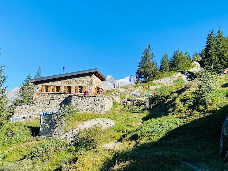
Sleeping places provided: 4 This hut, once occupied by a shepherd, has been gradually restored (including the furniture, cupboards, etc.) and is maintained by a solitary, anonymous volunteer (see the hut logbook)... TRY TO RESPECT THEIR WORK!!! And let it be known that on "refuges.info" they can find willing helpers... Small stone hut, a single room. Table, two benches, small cupboard, broom, cutting tools. A ladder leads to a loft where a little dry straw has been laid as a mattress: 4 or 5 people can sleep there by squeezing in a bit. A rather primitive fireplace: a hearth made of large stacked stones, topped by a crude metal hood set into the wall... the heating power of this setup is not guaranteed! Clean and in generally good condition (frames, masonry), with perhaps a few draughts in the loft, and some lingering traces of damp (metal roof needs looking at). Hut logbook (started in 2002, half full). Water a few steps away in the stream (flow to be checked in autumn WARNING: The remarks and caveats about access in winter, early spring or heavy rain, given on the listing for the Cabane du Col (see that name), also apply here!!! I'm changing the name so it matches local mapping...As this term is very common in alpine place names, there may be duplicates in the future. Mapping: IGN 1:25000 3336 OT "La Mure - Valbonnais". Vehicle access identical to [->1260]. After leaving the car park, you almost immediately hit a fork, at the signpost marked "Vaunoire". Leave the track heading straight east and take, to the right, a trail marked with yellow flashes that immediately crosses the stream on a wooden bridge to follow the left bank westward. Shortly after, another fork (signpost) where a very well-marked trail starts on the left, climbing very steadily (one of its charms) through countless switchbacks. This is very well shown on the IGN map. Winding along a wooded spur between two streams, you climb almost entirely in the shade. At around 1400 m, an area cleared by chainsaw. The damage doesn't appear to date from winter 2005/2006, and seems due more to a blast effect (powder-snow avalanche) than a wet-snow slide (large trees uprooted on the spot, no sign of debris carried downhill). You cross the stream running west of the trail, then cross it again to return to the original bank, and a few switchbacks bring you to the treeline and the hut, reached after crossing the eastern stream at the very last moment. Private hut, left open at visitors' own responsibility.